Highlights from Sacred Destinations
Explore the site
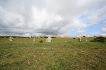
The Hurlers consist of three stone circles in a line running NNE to SSW.
/ England / Hurlers Stone Circles
Sacred site · 1500 BCE
Dating from about 1500 BC, the Hurlers are a set of three stone circles between two hills and two rivers near the town of Liskeard in central Cornwall.
The Hurlers are three stone circles in a line across the scenic landscape of Bodmin Moor in Cornwall. They date from about 1500 BC and are named for the medieval legend that they were men turned to stone for hurling (a Celtic game) on Sunday.
The Hurlers date from the Bronze Age and were erected in about 1500 BC. As with virtually all prehistoric standing stones, their exact purpose is not known.
There are a number of multiple stone circles in southwest England, which are usually found on sites between rivers. This indicates it may have been for the use of traders and travellers.
The name "Hurlers" for the stone circles dates probably from the Middle Ages; it was recorded by the historian William Camden in 1610, who explained local "devout error" had it that they were men turned into stone for playing the Celtic game of hurling on Sunday.
The Hurlers date from the Bronze Age and were erected in about 1500 BC .
The name "Hurlers" for the stone circles dates probably from the Middle Ages; it was recorded by the historian William Camden in 1610, who explained local "devout error" had it that they were men turned into stone for playing the Celtic game of hurling on Sunday.
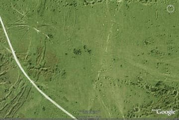
The Hurlers consist of three stone circles in a line running NNE to SSW. They are strategically located on a high moorland pass between two hills (Stowe's Hill to the north and Caradon Hill to the south) and two rivers (the tributaries of the River Fowey to the west and the River Lynher on the east).
The southernmost stone circle is incomplete and difficult to see, but the other two have been restored. The stones in the circles have different shapes but are skillfully placed so they appear to be the same height. The central and the northern stone circles were once linked together by a granite pathway that ran through their central axis.
The central circle has an elliptical shape and is the largest of the three circles, with 14 stones measuring 41.8m x 40.5m (137x133') along its major and minor axis. The stones of this circle were smoothed by hammering, leaving quartz crystals spread over the interior of the central circle.
The fallen southernmost circle is also the smallest circle, made of nine stones and measuring 32.9m (105') in diameter. The northern circle is 34.7m (114') in diameter and currently has 15 stones, though four have fallen and there were originally 24 stones in total.
About 120m (320') west-southwest of the Hurlers are two standing stones called "The Pipers," spaced 2.1m (7') apart. The northern stone circle was crossed by a boundary bank so the Pipers could be boundary posts, although some scholars think they have an astronomical role. One is 1.7m (5' 5") tall, the other is 1.4m (4' 9").
Highlights from Sacred Destinations
Highlights from Sacred Destinations
Advertisement
Advertisement
Advertisement
Where on earth