Highlights from Sacred Destinations
Explore the site
Mont-Saint-Michel is connected to the mainland via a thin natural land bridge, which before modernization was covered at high tide and revealed at low tide, giving the mount a mystical quality.
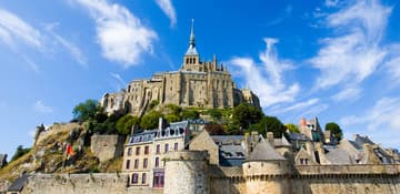
/ France / Mont St-Michel
St. Michael
This small rocky island just off the north coast of France is topped with a magnificent fortified Benedictine abbey, built in the 11th century.
Mont-St-Michel (also written Mont Saint Michel) is a small rocky island about 1 km from the north coast of France at the mouth of the Couesnon River in Normandy.
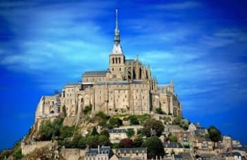
The mount is best known for the medieval Benedictine Abbey and steepled church that occupies most of the 1km-diameter clump of rocks jutting out of the waters of the English Channel.
Le Mont-St-Michel was used in the 6th and 7th centuries as a stronghold of Romano-British culture and power until it was sacked by the Franks; thus ending the trans-channel culture that had stood since the departure of the Romans in 459 AD.
Before the construction of the first monastic establishment in the 8th century, the island was called Mont Tombe. According to legend, the archangel Michael appeared to St. Aubert, bishop of Avranches, in 708 and instructed him to build a church on the rocky islet.
But Aubert repeatedly ignored the angel's instruction until Michael burned a hole in the bishop's skull with his finger. That did the trick. The dedication to St Michael occurred on October 16, 708.
The mount gained strategic significance in 933 when the Normans annexed the Cotentin Peninsula, thereby placing the mount on the new frontier with Brittany. It is depicted in the Bayeux Tapestry, which commemorates the 1066 Norman conquest of England. Ducal and royal patronage financed the spectacular Norman architecture of the abbey in subsequent centuries.
Legend has it that the Archangel Michael appeared to Aubert, Bishop of Avranches, inspiring him to build an oratory on what was then called Mont Tombe.
An Italian architect, William de Volpiano, designed the Romanesque church of the abbey in the 11th century, daringly placing the transept crossing at the top of the mount. Many underground crypts and chapels had to be built to compensate for this weight. These formed the basis for the supportive upward structure that can be seen today.
Robert de Thorigny, a great supporter of Henry II of England (who was also Duke of Normandy), reinforced the structure of the buildings and built the main façade of the church in the 12th century. Following his annexation of Normandy in 1204, the King of France, Philip Augustus offered abbot Jourdain a grant for the construction of a new gothic style architectural set which included the addition of the refectory and cloister.
The wealth and influence of the abbey extended to many daughter foundations, including St Michael's Mount in Cornwall, England. However, its popularity and prestige as a centre of pilgrimage waned with the Reformation and by the time of the French Revolution there were scarcely any monks in residence.
During the Revolution the abbey was closed and converted into a prison, initially to hold clerical opponents of the republican régime. High-profile political prisoners followed, but by 1836 influential figures, including Victor Hugo, had launched a campaign to restore what was seen as a national architectural treasure. The prison was finally closed in 1863, and the mount was declared a historic monument in 1874. Mont Saint Michel and its bay were added to the UNESCO list of World Heritage Sites in 1979.
Le Mont-St-Michel was used in the 6th and 7th centuries as a stronghold of Romano-British culture and power until it was sacked by the Franks; thus ending the trans-channel culture that had stood since the departure of the Romans in 459 AD.
Aubert, bishop of Avranches, in 708 and instructed him to build a church on the rocky islet.
Mont-Saint-Michel is connected to the mainland via a thin natural land bridge, which before modernization was covered at high tide and revealed at low tide, giving the mount a mystical quality.
However, the insular character of the mount has been compromised by several developments. The Couesnon River has been canalized, reducing the flow of water and thereby encouraging a silting-up of the bay. In 1879, the land bridge was fortified into a true causeway. This prevented the tide from scouring the silt round the mount. Now there are plans to remove the causeway and replace it with a bridge and shuttle.
The tides in the area shift quickly, and has been described by Victor Hugo as à la vitesse d'un cheval au galop, "as swiftly as a galloping horse." The tide actually comes in at 1 meter per second. Popularly nicknamed "St. Michael in Peril of the Sea" by medieval pilgrims making their way across the tidal flats, the mount can still pose dangers for visitors who avoid the causeway and attempt the hazardous walk across the sands from the neighboring coast. The dangers from the tides and quick sands continue to claim lives.
The climb to the abbey is hard -- by the time you have mounted the celebrated Escalier de Dentelle (Lace Staircase) to the gallery around the roof of the abbey church, you will have climbed no fewer than 900 steps -- but it's worth it. Halfway up Grande-Rue is the medieval parish church of St-Pierre, which features a richly carved side chapel with its dramatic statue of St. Michael slaying the dragon.
The Grand Degré, a steep, narrow staircase, leads to the abbey entrance, from which a wider flight of stone steps climbs to the Saut Gautier Terrace (named after a prisoner who jumped to his death from here) outside the sober, dignified church.
After visiting the arcaded cloisters alongside, which offer vertiginous views of the bay, you can wander at leisure, and probably get lost, among the maze of rooms, staircases, and vaulted halls that make up the abbey.
Highlights from Sacred Destinations
Highlights from Sacred Destinations
Advertisement
Advertisement
Advertisement
Where on earth