/ Israel / Caesarea Temples and Churches
Sacred site
Caesarea Temples and Churches
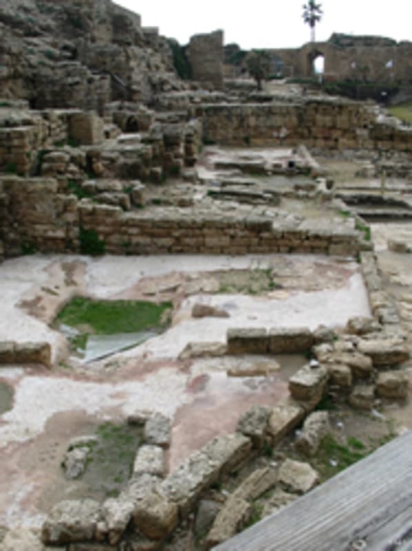
The elevated platform or podium near the harbor of Caesarea, which is still being excavated and studied, has been a place of worship for the Romans, Christians and Muslims.
The elevated platform or podium near the harbor of Caesarea, which is still being excavated and studied, has been a place of worship for the Romans, Christians and Muslims.
The first structure on the site was the Temple to the Divine Caesar (of which almost nothing remains), which dominated the great Roman city built by Herod the Great (22-10 BC). As we know from Josephus' description in The Jewish Wars, it featured two colossal statues: one of Augustus modeled after the Zeus of Olympia and one of Roma that resembled the Hera at Argos.
In the 6th century, an elegant Byzantine church was built over the site of Herod's temple. The Martyrion of the Holy Procopius (a martyr who was executed under Diocletian c. 303 AD) was an octagonal, 39 m.-wide church standing within a square precinct measuring 50 x 50 m., surrounded by rooms along its walls. The floor was paved with marble slabs in a variety of patterns. Of the rows of columns in the building, several Corinthian capitals decorated with crosses were found.
Interestingly, the pagan temple seems to have stood intact until it was replaced by the church in the 6th century, despite the conversion of the empire in the 4th century and the important religious role of Caesarea as a bishopric and home of several martyrs as well as the Christian scholars Origen and Eusebius. There were, however, other churches built in Caesarea before this time.
After the Islamic conquest, a great mosquewas built on or near the site of the Byzantine church. Then, in the Crusader period, it was home to the Cathedral of St. Peter. The 12th century cathedral, the eastern part of which was added in the middle of the 13th century, was a modest structure measuring 55 x 2 m. The hall was divided into a central nave and two aisles that ended in the east in three apses; the floor was paved in mosaics. The vaulting was supported by rectangular piers and pilasters.This seems to have been damaged or demolished by the Ayyubids.
The existing apse with polygonal exterior is probably part of the foundations of a tempoary edifice (c.1228), behind which the three apses of the 13th-century Crusader church were being constructed. Subsequently this single apse was buried beneath the floor of the new church, which was standing in 1265 when Sultan Baybars made it his command post for the siege of the Crusader fortress.
Advertisement
Advertisement
Advertisement
Gallery
Location
Where on earth