Highlights from Sacred Destinations
Explore the site
The first sight in the main area of the park is the Earth Lodge , a reconstructed council chamber of the Mississippian people that incorporates and protects the original 1,000-year old floor.
/ Georgia / Ocmulgee National Monument
Sacred site · 900-950
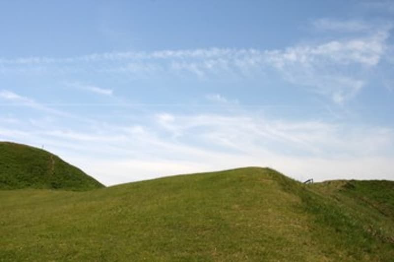
Located in Macon, Georgia, Ocmulgee National Monument includes several burial mounds and an earth lodge built by the Mississippian people around 900-950 AD.
The Ocmulgee National Monument in Macon, Georgia is a national park preserving an area that has been inhabited for over 11,000 years - "from the Ice Age to the Space Age." It centers around several burial mounds and an earth lodge built by the native Mississippian people around 900-950 AD.
The Macon Plateau has been inhabited by humans since the Ice Age (before 9,000 BC). A "Clovis" spear point left by these ancient peoples was discovered at Ocmulgee in the 1930s. By 8,000 BC people were hunting and gathering in the warmer post-Ice Age climage, and by 2,500 BC they were making pottery.
The period from 1,000 BC to 900 AD has been labeled the Woodland Period. During this time, the people who lived here were decorating their pottery, building villages and making contacts with the Adena/Hopewell cultures farther north and the Weeden Island culture in Florida and South Georgia.
By 900 AD, the Mississipian culture had emerged on the banks of the Mississippi River. In the Early Mississippian Period (900-1150), the great ceremonial center of mounds and earth lodges was constructed on the Macon plateau. The Lesser Temple Mound and Greater Temple Mound date from this period.
In the Mature Mississippian Period (1150-1350), this town declined and the Lamar and Stubbs Mounds and Villages appeared downstream, exhibiting a combination of the old Woodland culture and Mississippian ideas.
The Lamar culture became even more widespread in the Late Mississippian Period (1350-1650). This was characterized by chiefdoms of small villages, each with a ceremonial center marked by one or two mounds. In the mid-1500s, the Spanish expedition of Hernando DeSoto arrives in the area, marking the beginning of the end of the Native American way of life in this area.
The period from 1,000 BC to 900 AD has been labeled the Woodland Period .
In the Mature Mississippian Period (1150-1350), this town declined and the Lamar and Stubbs Mounds and Villages appeared downstream, exhibiting a combination of the old Woodland culture and Mississippian ideas.
The first sight in the main area of the park is the Earth Lodge, a reconstructed council chamber of the Mississippian people that incorporates and protects the original 1,000-year old floor. A circle of seats and the symbolic bird effigy bring to life this building that had both political and spiritual significance. This is the largest of eight earth lodges discovered on the Macon Plateau.
From the Visitor's Center, a path leads past an early English trading post to the Lesser Temple Mound and Great Temple Mound, constructed around 900-950 AD during the Early Mississippian Period. You can climb the Great Temple Mound for a fine view of the city of Macon and the Ocmulgee National Monument.
The mounds were originally topped with rectangular wooden structures, probably for ritual use, and a steep rampway descended from the summit to the plaza below. The purpose of the mounds is not known for certain, but their existence seems to indicate a class of priests and/or cheiftains who were greatly honored at their death.
The Lamar Mounds site includes the only known spiral mound in North America. Standing 20 feet tall, the mound was built and used from 1350 till the late 1500s. This mound is accessable during low water levels of the Ocmulgee River on a ranger-lead tour several times a year.
Highlights from Sacred Destinations
Highlights from Sacred Destinations

Advertisement
Advertisement
Advertisement
Where on earth